TOURISTIC INFORMATION
Points of Interest about the surrounding area of the Event
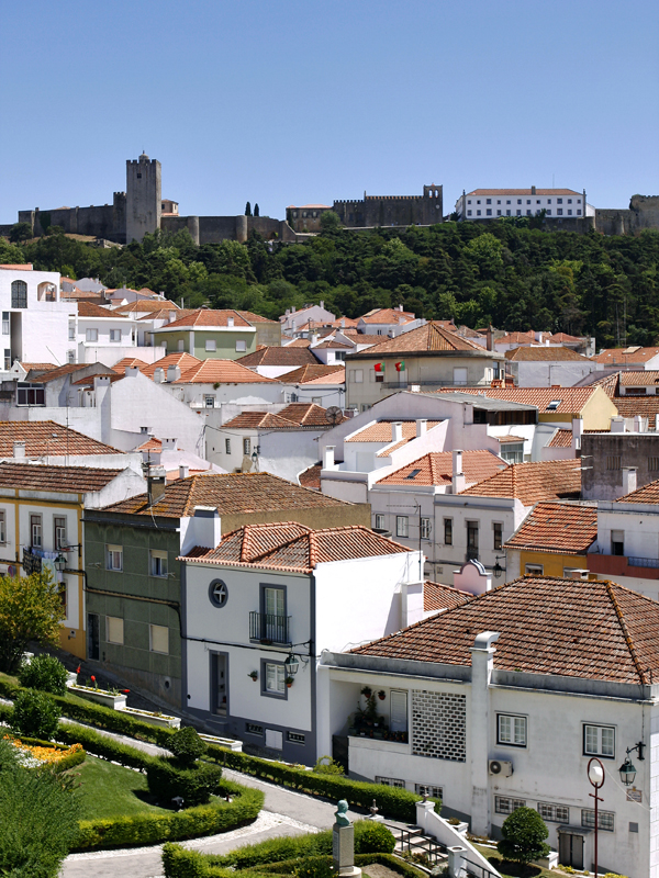
VILLAGE OF PALMELA

“Palmela is a Portuguese village belonging to the district of Setúbal , a region of Lisbon and sub-region of the Setúbal peninsula, with about 19,500 inhabitants. Its maximum altitude is 378 meters, measured on the hill where is the Castle.
It is the seat of a municipality with 465.12 km² and 62 831 inhabitants (2011), subdivided into 4 parishes . The city is bordered to the north by the municipalities of Benavente and Alcochete , northeast through the eastern portion (exclave) of the municipality of Montijo , east of Vendas Novas , southeast of Alcácer do Sal , south of Setubal , to the west by Barreiro and northwest by Moita and the western portion (main area) in the city of Montijo. […]
The presence of man in the area that is now occupied by the city of Palmela dates back to the Neolithic era, where its presence is quite noticeable, especially during the culture bell , and whose testimony has been left in the form of world-famous Palmela vase . Occupied by Celts, Romans and Arabs, all they found in this territory a strategic place to settle. In 1147 it was conquered by D. Afonso Henriques , granting it a charter in 1185 . But the golden age of Palmela can be found in the early years of Nationality, when Palmela was the key of the territory between the Sado and Tagus. This strategic importance due to cyclical aspects of political and religious nature related to the process of conquest and consolidation of the Portuguese State, and which The Order of Santiago and Sword , (which received Palmela as donation D. Afonso Henriques around 1172 ), it cannot be separated. The Order of Santiago mark its presence in Portuguese society to be lady of a vast territory that stretched from the ancient city of Riba Tejo (encompassing the current municipalities of Barreiro , Moita , Montijo and Alcochete ) to Mértola , in the Alentejo. The Order’s administrative power happens to be centered in Palmela “already in the time of Infante D. João, son of D. João I”
Source: Wikipedia
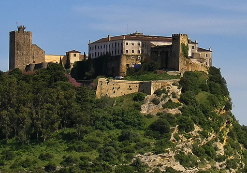
PALMELA's CASTLE
“The Palmela Castle is located in the village, parish and county of the same name , district of Setúbal , in Portugal.
In Setúbal Peninsula , in the foothills east of the Arrábida mountain, it is situated between the estuaries of the Tagus and Sado river , near the mouth of the latter. Is part of the so-called Riviera , in the Arrábida Natural Park . From the top of its main tower , on a clear day the view unfolds to Lisbon . […]
At the time of the Reconquista Christian of the Iberian peninsula , after the conquest of Lisbon ( 1147 ) by the forces of D. Afonso Henriques (1112-1185), came to fall in the same year Sintra , Almada and Palmela. At the time, the Muslim forces who defended Palmela, abandoned it, taking refuge in Alcacer do Sal . In this way, the Portuguese forces only ruled over the village and its fields. Muslim forces, however, soon regrouped, regaining south of the Tagus river. Christians reconquered Palmela in 1158 .Again lost, it was finally conquered by the sovereign on June 24 of 1165 . From the following year reinforcement works were carried.”
Source: Wikipedia

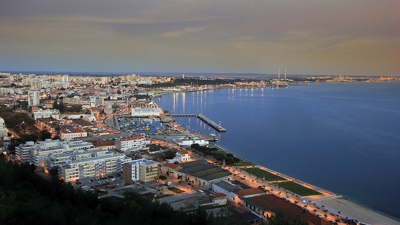
CITY OF SETÚBAL

“Setubal is a Portuguese city, capital of the district of Setúbal (since 1926) and seat of the diocese (since 1975), located in the region of Lisbon and sub-region of the Setúbal peninsula , with 90,640 inhabitants in its urban area.
It is the seat of a municipality with 230.33 km² and 121 185 inhabitants (2011), divided into five parishes . The city is bordered to the west by the municipality of Sesimbra , northwest by Barreiro, north and east by Palmela and on the south, the Sado estuary separates the municipalities of Alcácer do Sal and Grândola . The peninsula of Troia , belonging to Grândola, is located in front of the city, between the Sado estuary and the coast of the Atlantic Ocean .
Setubal has existed since the time of the Romans (and then a village) with the nearby town Palmela was conquered by Afonso Henriques in 1147 . [..]
Setúbal was born the river and the sea. The records of human occupation in the territory of the municipality date back to prehistoric times, having been collected in various locations, numerous remains the Neolithic. It was visited by Phoenicians , Greeks and Carthaginians , who came to Iberia in search of salt and tin, including Alcácer do Sal , then being navigable river to this village.”
Source: Wikipedia
SERRA DA ARRÁBIDA
“The Serra da Arrábida is composed by rough terrains with strong levels situated on the north bank of the Sado River estuary , in the Peninsula of Setubal , Portugal , with the highest point at 501 meters altitude and peculiar characteristics of climate and flora .
Its climate is temperate Mediterranean , with a rich flora in Mediterranean species such as the holm oak, cork oak, oak. […]
The Arrábida Natural Park , founded in 1976, with an approximate area of 10 800 hectares, protecting the vegetation maquis of Mediterranean type born of this microclimate similarities with the Adriatic regions such as Dalmatia.
The fauna is diverse, despite having undergone major changes since the nineteenth century. By the early twentieth century it was still possible to observe wolves , boars and deer . The current fauna are part of, among others, the wildcat (Felis silvestris), the fox (Vulpes vulpes), the hare (Lepus capensis), the bat , the eagle Bonelli (Hieraetus fasciatus) the eagle owl (Bubo Bubo) the partridge (Alectoriz rufus) and the swift real (Apus melba).
In 2004, as previously happened, a fire destroyed a significant part of the park, which is slowly recovering.”
Source: Wikipedia

